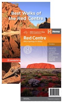
Description
The heart of Australia contains a wealth of treasures: red-walled gorges, idyllic waterholes, fascinating formations and the culture of people who have inhabited this landscape for many millennia. It is a diverse landscape of arid flatlands, striped with ancient ranges and hidden, lush gullies. The best way to discover this colourful natural beauty is on foot. Best Walks of the Red Centre, introduces the best walks for visitors and locals alike, ranging from strolls along well-laid footpaths to more difficult hikes up rugged ridges and along remote river beds. The book and regional map covers many walks in and around Alice Springs, along the MacDonnell Ranges and the Red Centre Way, plus the iconic walks to be found around Uluru and Kata Tjuta, Watarrka and Rainbow Valley.

Reviews
There are no reviews yet.