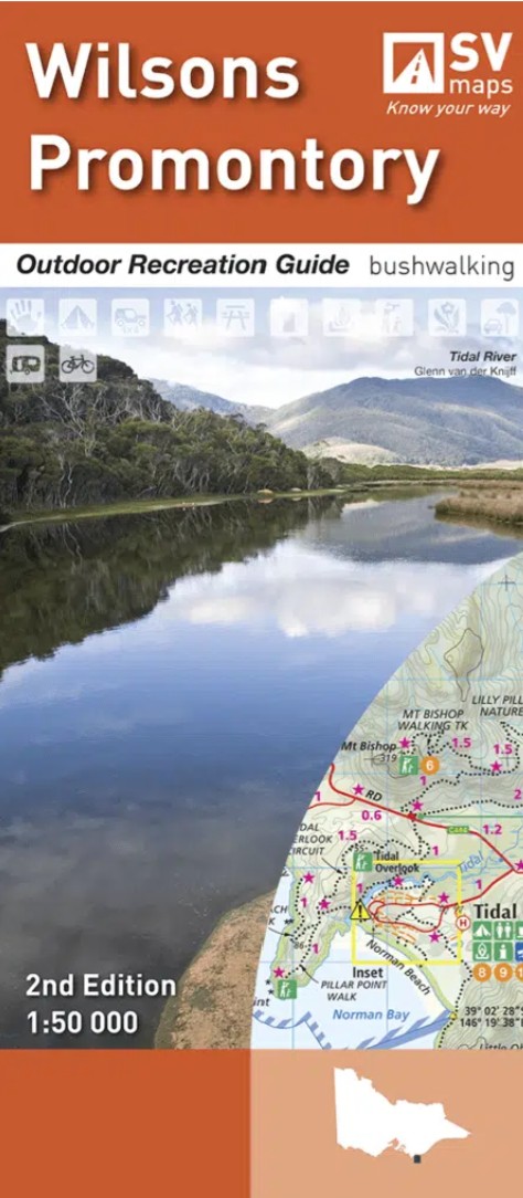
Description
2nd edition of the Wilsons Promontory National Park by Spatial Vision. Covering one of Australia’s most iconic national parks, this map is your essential guide to bushwalking, coastal trekking, backcountry camping, climbing, kayaking, and more. Whether you’re standing on the white sands of Refuge Cove or summiting Mount Oberon, this map brings the entire Prom into clear focus.
Designed for adventurers and nature lovers, the 1:50,000 scale provides exceptional detail of the Prom’s unique coastal and mountainous terrain — making it perfect for trip planning, classroom use, navigation, or wall display.
Available as a Print on Demand map.


Reviews
There are no reviews yet.