
Description
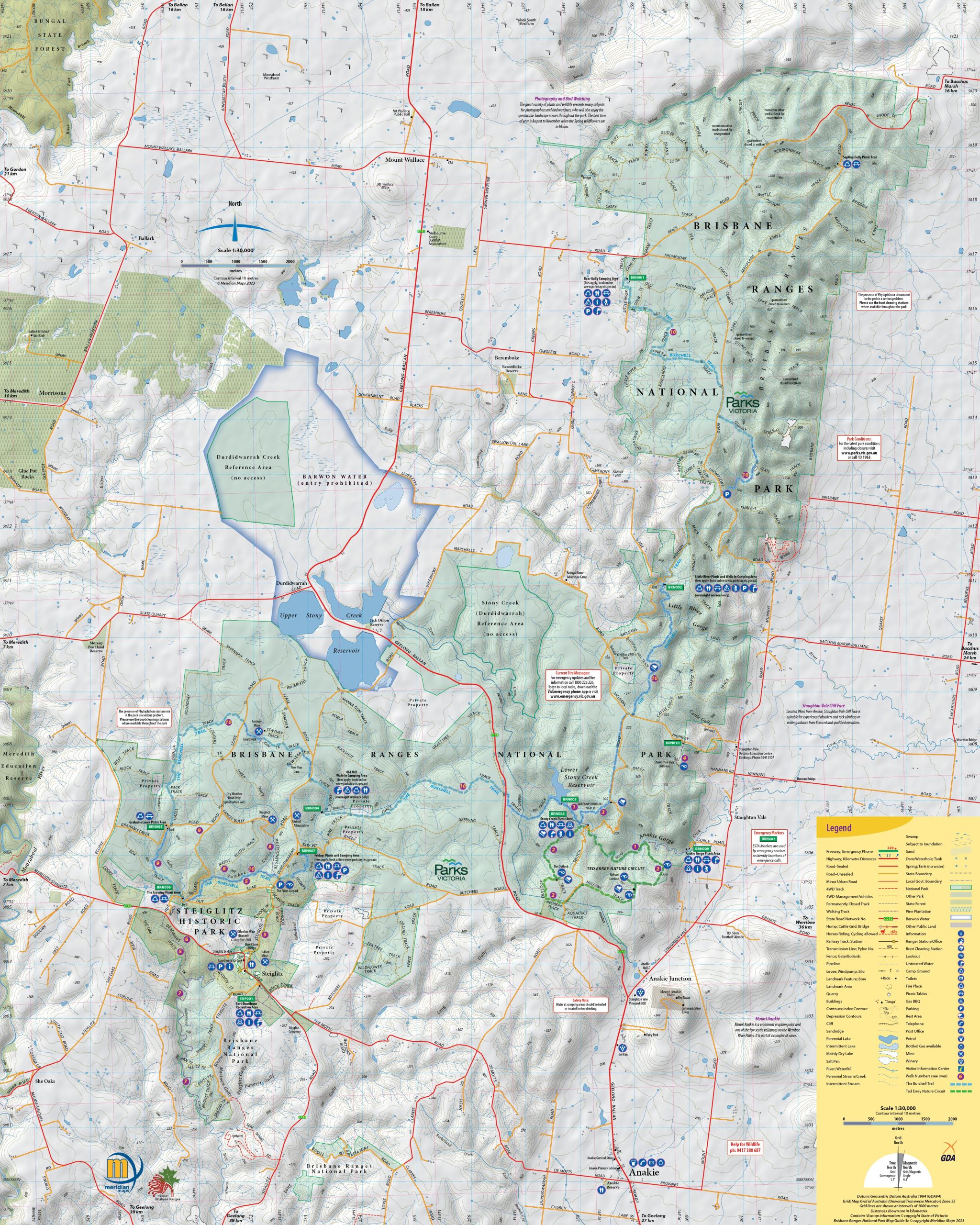
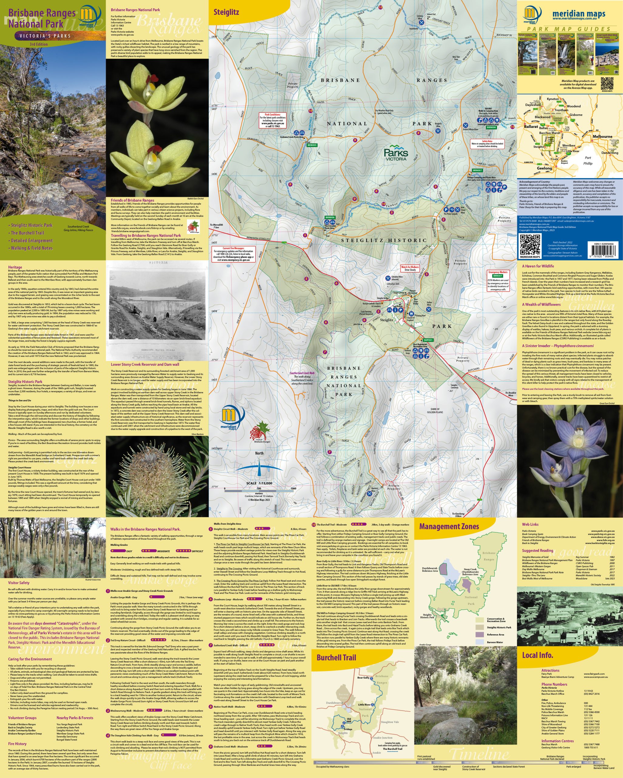
Unleash your sense of adventure with the 3rd edition of the Brisbane Ranges National Park Map Guide. This beautifully detailed guide helps you explore the breathtaking landscapes of the park, located in the Barwon region, between Melbourne and Gelong . Spanning an impressive 7,718 hectares, Brisbane Ranges National Park is just 80 kilometers west of Melbourne, near the charming town of Meredith. Managed by Parks Victoria, this pristine wilderness is a haven for nature lovers.
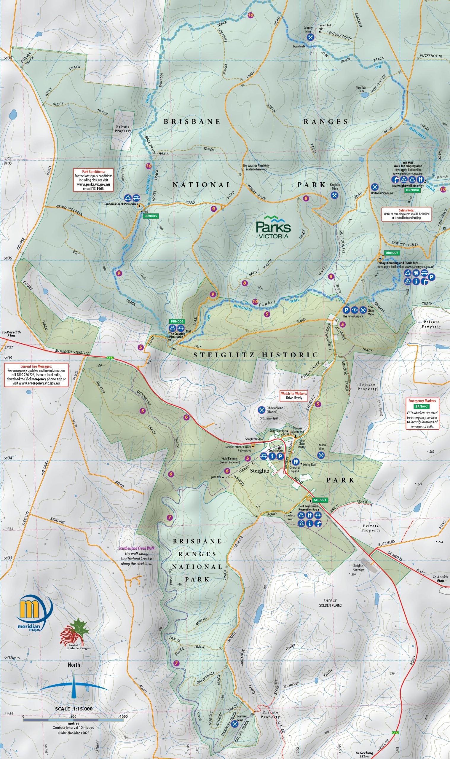
Created at a scale of 1:30,000, this exceptional map covers the entire Brisbane Ranges National Park with an enlargement of the historically rich Steiglitz Historic Park. The guide features the renowned 3-Day Burchell Trail, inviting you to embark on an unforgettable journey through these captivating parks.
There are 10 updated walking trails complete with track notes and essential tourist information. It’s perfect for bushwalkers and day-trippers looking to explore the beauty of the area. Plus, check out the newly aligned Steiglitz Circuit Walk—just head to the Notes tab to download the map and walk description.
Prepare for an adventure filled with stunning scenery and unforgettable experiences in the Brisbane Ranges National Park.
Go to Notes tab to download the new route of the Steiglitz Circuit Walk – Feb 2024.


Reviews
There are no reviews yet.