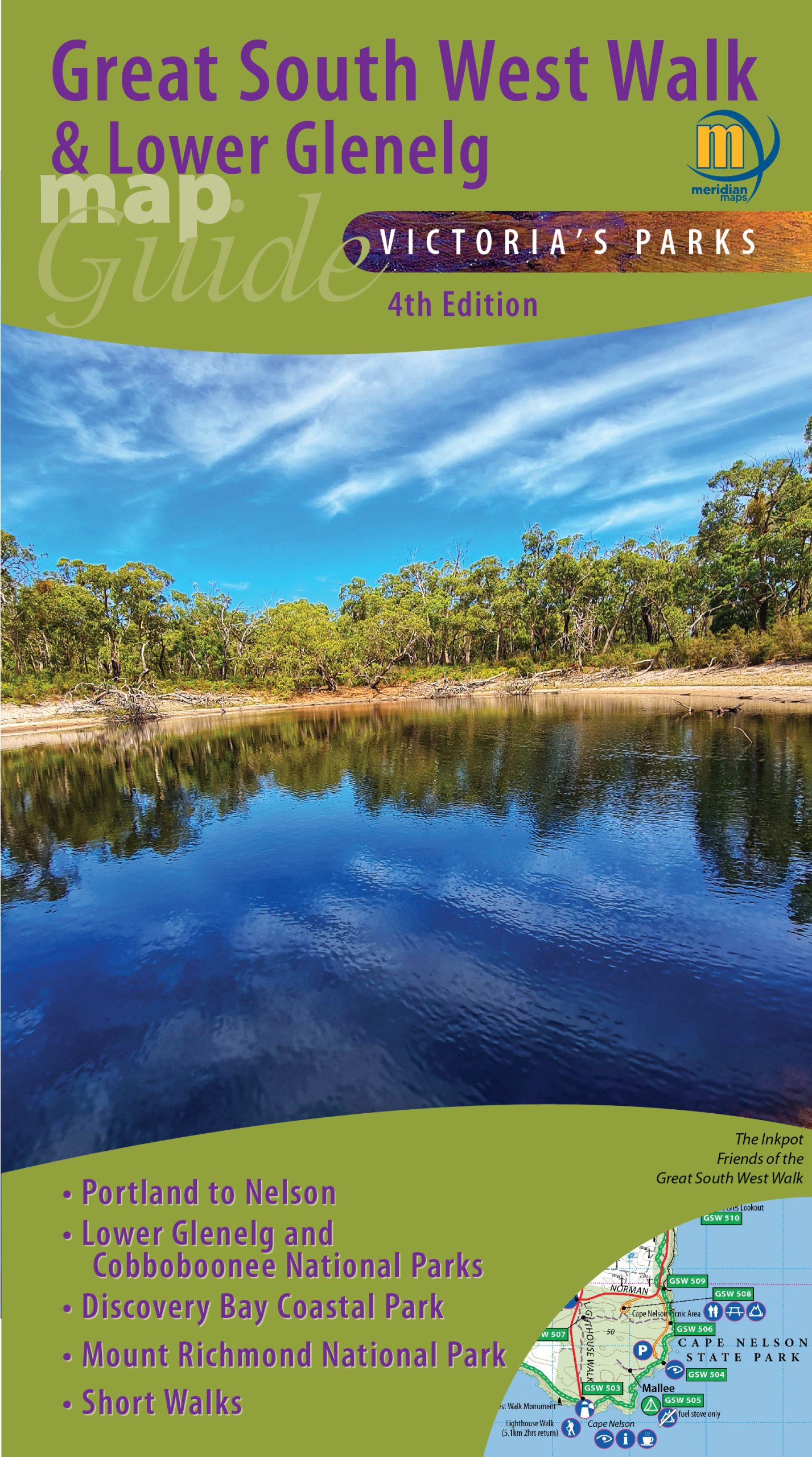

Great South West Walk Map Guide 4th Edition
Price range: $15.95 through $27.95
- 4th Edition October 2023
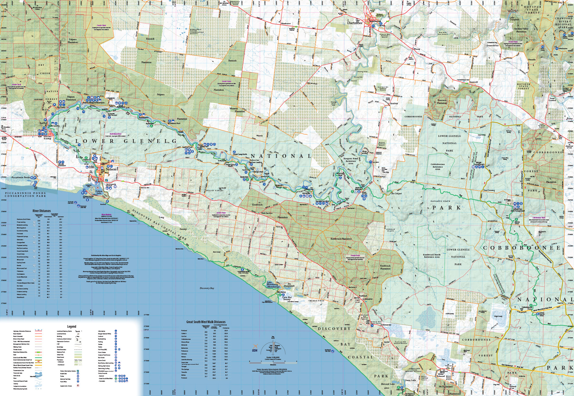
- Scale 1:50,000
- Suitable for use with GPS
- Shows all Emergency Markers
- Double-sided with overlapping area
- Covers Nelson to Dartmoor and Portland
- Features the Great South West Walk
- Includes walk and river travel times
- Covers Lower Glenelg & Cobboboonee National Parks
- Includes Short Walks Times and Distances
- Map size 138mm(W) x 250mm(H) folded
- ISBN: 9781920958527
- Available Folded, Flat, Laminated and Folded/Laminated
- Available in PDF format from Avenza Maps
Embark on an unforgettable journey along the Great South West Walk, a stunning 262km loop trail nestled in the breathtaking south-west corner of Victoria. Celebrated as one of the state’s finest long-distance hikes, this trail begins in the charming town of Portland and winds through to Nelson and back, offering a mesmerizing mix of landscapes, from picturesque coastlines and native forests to dramatic limestone cliffs, rolling sand dunes, and pristine white beaches.
Whether you're an avid hiker or just looking for a leisurely stroll, the walk can be tailored to your preferences. With multiple sections available, you can choose to tackle shorter walks or embark on a multi-day adventure, breaking your journey at the well-equipped campsites along the route.
This 4th edition topographic map is your essential companion for navigating the entire Lower Glenelg National Park, Cobboboonee National Park, Mt Richmond National Park, and Discovery Bay Coastal Park. At a convenient 1:50,000 scale, it covers all 262km of the trail, highlighting designated campsites and key points of interest.
Perfect for bushwalkers, canoeists, fishers, and 4-wheel drive enthusiasts, this map also includes details for the Wood, Wine & Roses Forest Drive and the Great Cobboboonee Horse Trail. Plus, you’ll find crucial emergency markers and short walk options for added safety and convenience.
Get ready for an incredible outdoor experience filled with stunning scenery and endless adventure on the Great South West Walk!
Additional information
| Weight | 0.09 kg |
|---|---|
| Format | Folded, Flat, Laminated, Folded & Laminated |


Judd Taylor –
Great map – very clear and accurate