Meridian Maps
+61 3 9576 8448
0468 851 097 
[email protected]

Binns Track Atlas Digital

$30.95

  • 2nd Edition
  • Scale 1:800,000
  • Field Checked with GPS
  • Detail roads and tracks
  • National Parks and Reserves
  • Specific 4WD, caravan and camping information
  • Cultural, historical and tourist information
  • Informative text about the region
  • Digital Version for OziExplorer only
SKU: W008D Category:

Description

OziExplorer Digital Version. 
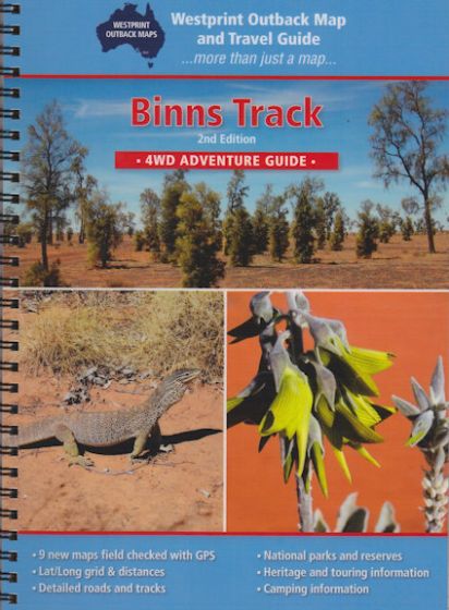
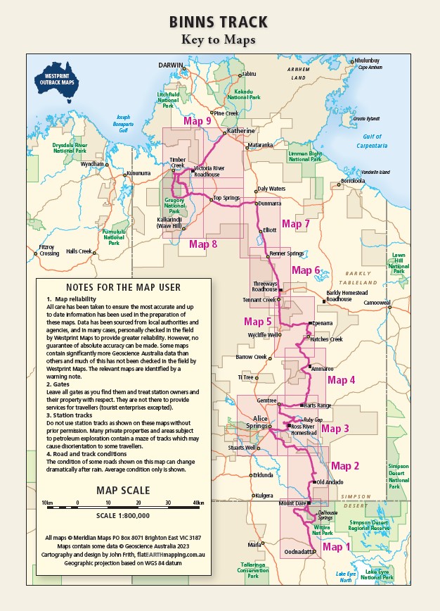
The Binns Track is a remarkable four-wheel drive adventure that traverses breathtaking scenery, offering the chance to discover some of the lesser-known sights of the Northern Territory. Starting at the South Australian border, the Binns Track meanders through remote national parks, amazing camping spots, and distant outback towns. Spanning 2,230 kilometres, the track is named after Bill Binns, a ranger who dedicated 32 years to NT Parks and Wildlife. Bill’s vision was to enable visitors to explore more of Central Australia, uncovering its vibrant colours, native wildlife, and majestic rock formations.

Thousands of experienced 4WDrivers have enjoyed the amazing diversity of Northern Territory landscapes ranging from deserts to tropics with matching wildlife and vegetation. The Binns Track is made up of varying road surfaces from bitumen highways to rugged, tyre-punishing rocky tracks and is not to be taken lightly. However, it is a track that has a regular flow of traffic and a small convoy of two or three vehicles will increase the safety margin immensely.

Additional information

Weight 0.0 kg
Format

Folded, Laminated

Download Information

Download Information

Instructions for downloading Ozf format maps

Please read these notes carefully before proceeding

Only buy these maps if you have OziExplorer software installed (or intend to install it) on your computer. A FREE Trial version of OziExplorer can be downloaded from: http://www.oziexplorer.com/

The maps are in OziExplorer (Ozf4) file format. Map image and calibration files are in a Zip folder and require Winzip or a similar program so they can be unpacked and made ready for use.

For each map you wish to purchase, click the “Add to Cart” link. If more than one map is required, continue shopping by adding further maps to the Cart.

Important

Once your order has been received, we will send a Hightail link by email to begin downloading the files.  Note: the download system works best for payment by credit card. (If you select payment by bank deposit, download will not begin until receipt of payment to our account has been confirmed. This may take at least 2 working days for your funds to appear in our bank account).

Please remember that these files are your personal use only.

Only maps suitable for use with OziExplorer navigation software are available for download from this site.

Reviews

There are no reviews yet.

Be the first to review “Binns Track Atlas Digital”

Your email address will not be published. Required fields are marked *