Description
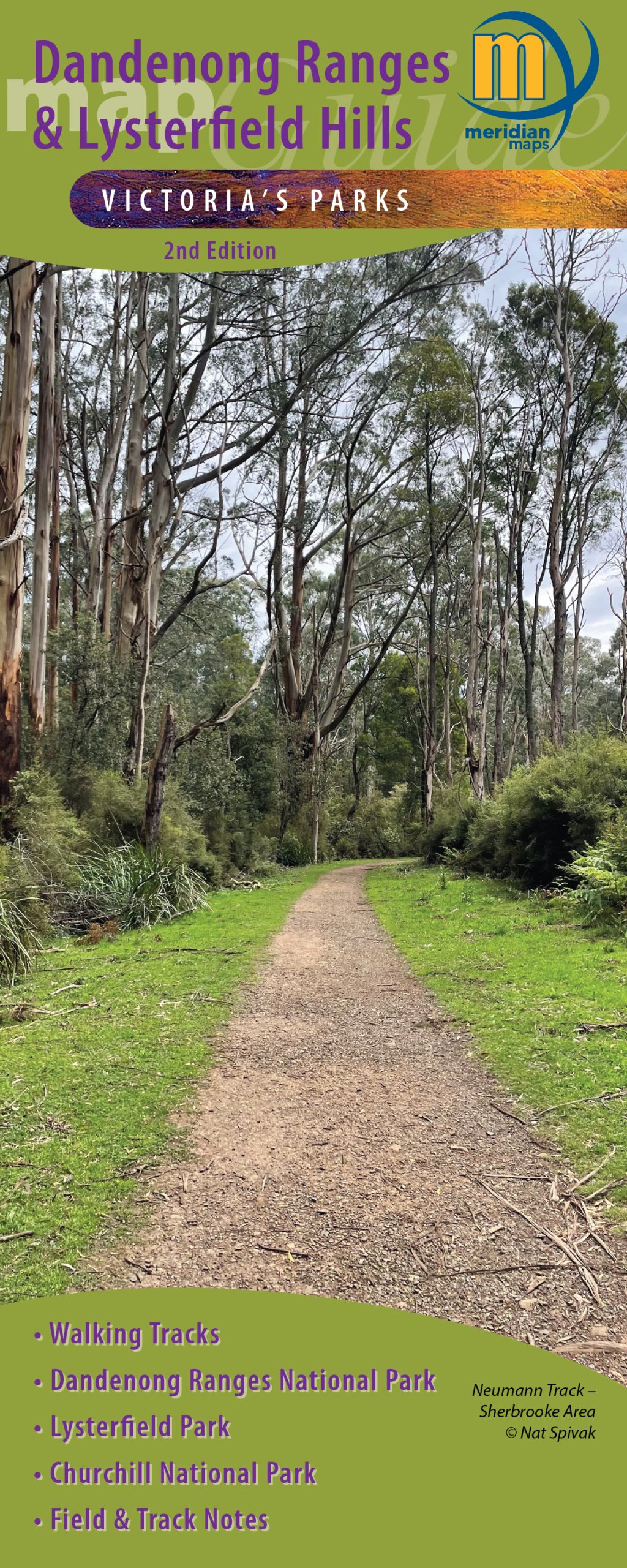
Explore the Dandenong Ranges: A Rainforest Getaway Near Melbourne with the Meridian Maps Dandenong Ranges & Lysterfield Hills Map Guide – 2nd Edition.
Published in April 2026, this new edition incorporates the latest park information on tracks and facilities, as well as local tourist sites, produce vendors and eating establishments.
Just a short drive or train ride from Melbourne the Dandenong Ranges are a lush rainforest escape featuring steep volcanic hills and the majestic Mountain Ash, the tallest flowering tree in the world. This natural wonderland offers a perfect retreat for nature lovers and adventure seekers alike.
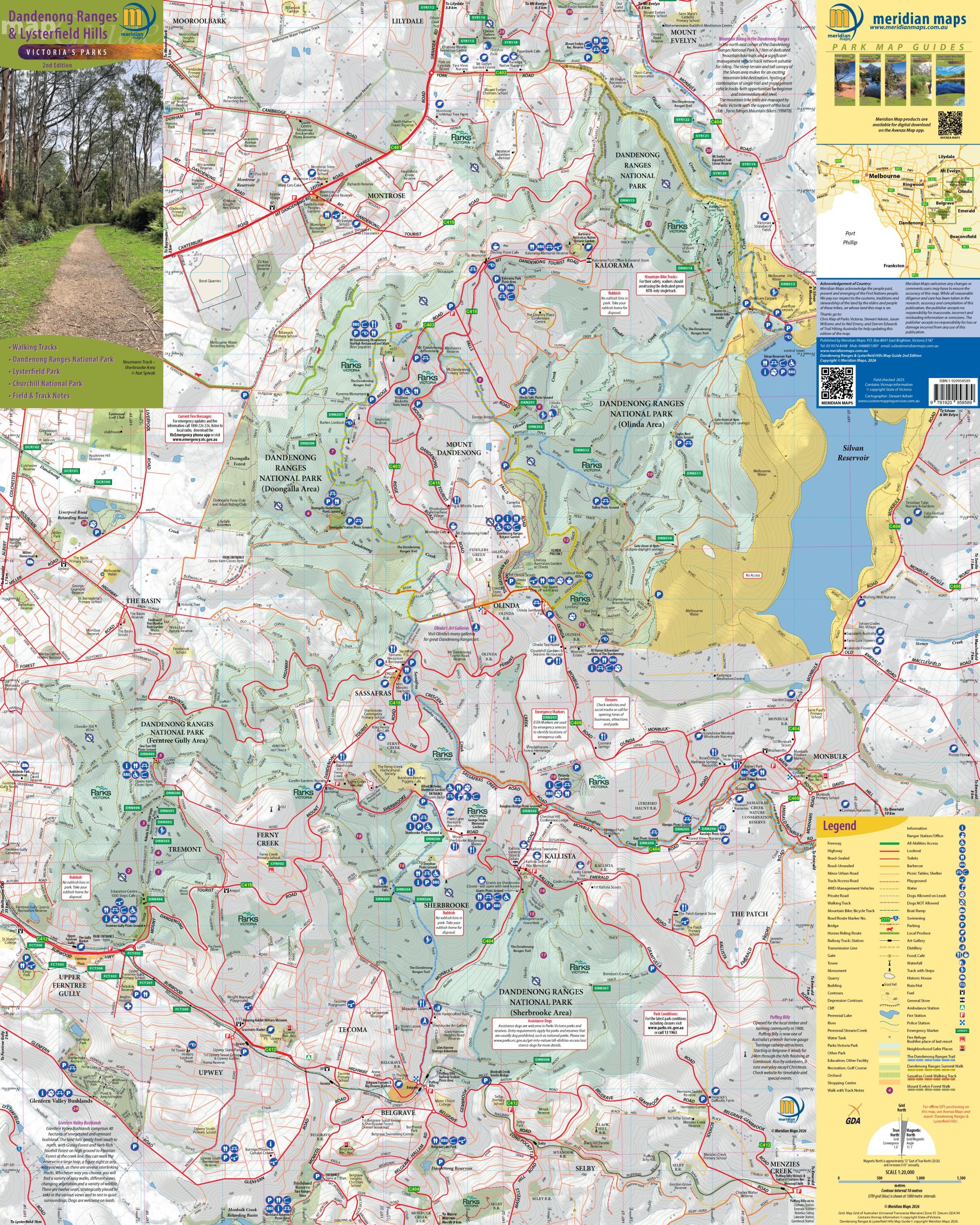
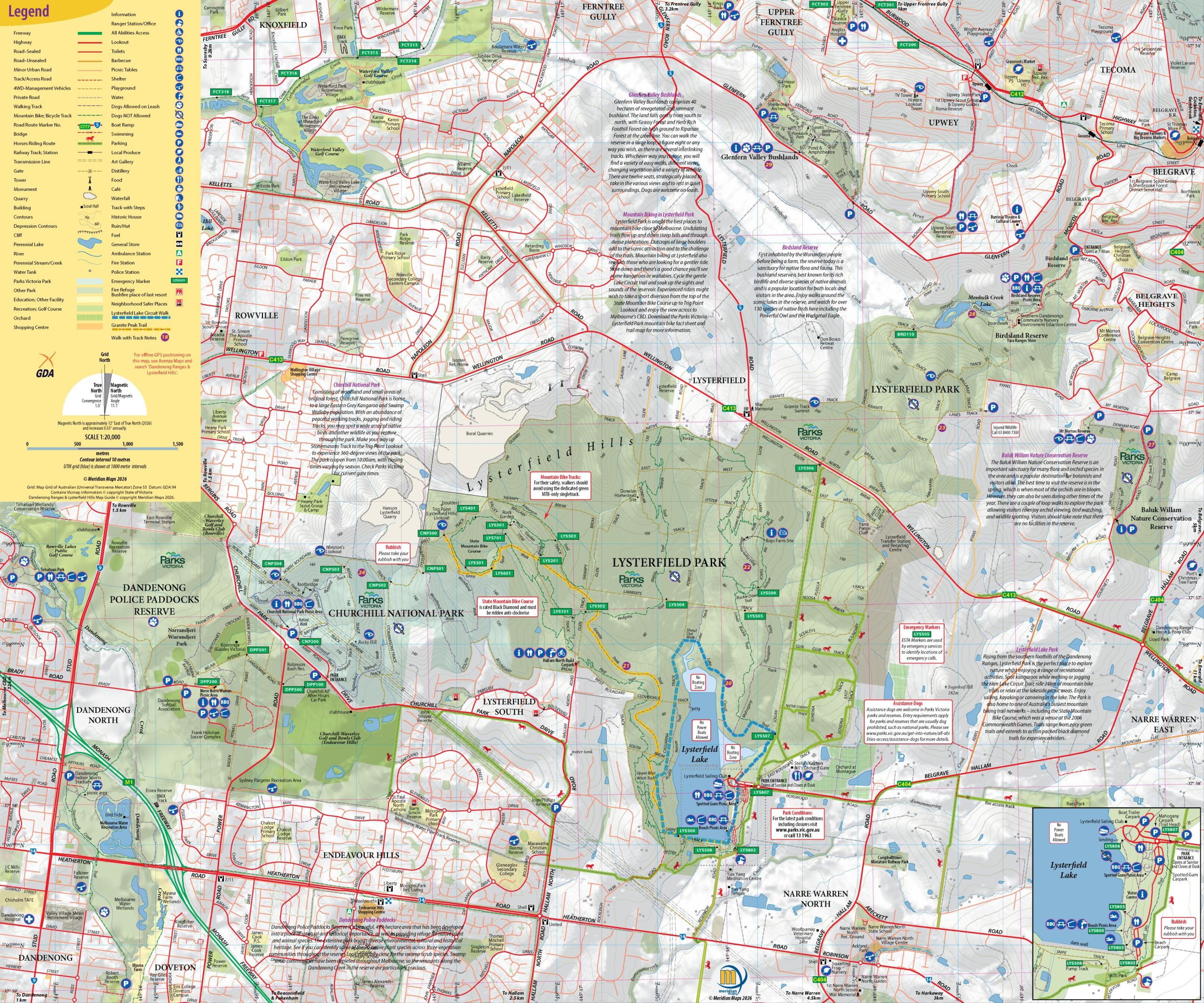
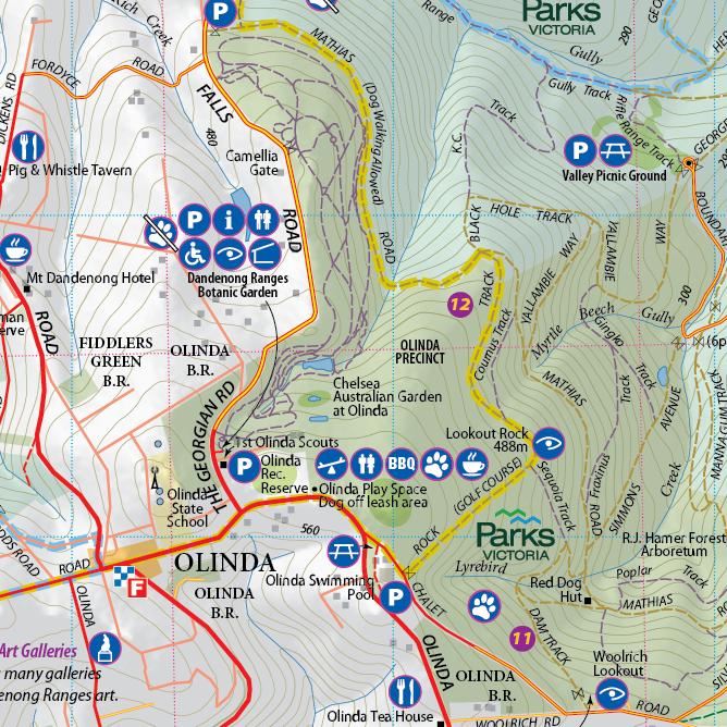
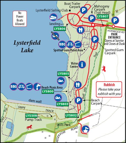
To help you navigate this stunning area, grab the 2nd edition of this double-sided 1:20,000 scale map of the Dandenong Ranges and Lysterfield Hills. This comprehensive map covers all the parks in the region, including Dandenong Ranges National Park, Churchill National Park, and Lysterfield Park. It highlights 32 walking trails, including the scenic Dandenong Trail and the Sassafras Walking Track, ensuring you won’t miss any of the breathtaking sights.
The map also features all tourist attractions, local producers, picnic grounds, and walking tracks, making it ideal for bushwalkers, day-trippers, mountain bikers, and holidaymakers. Whether you’re planning a leisurely day out or an adventurous hike, the Dandenong Ranges offers a delightful escape right on Melbourne’s doorstep.


Brendon Dennis –
I recently purchased two of your Dandenong Ranges laminated folded maps very professionally done. I am so pleased and dispatched very quickly to me in Brisbane thank you very much
Neil –
I have a folded version of this map. The paper quality is really good and the style of the map is very clear and includes 10 metre contours so you can see what you are getting into. There are brief notes on a lot of the walking tracks throughout the Dandenongs as well. Customer service is great too.
Nicholas –
A great Map, plenty of detail even of the more out of the way/remote localities. The map is printed a substantial grade paper so it will undoubtedly be farely durable. The detail is quite clear and easy to read. I’m quite happy with it and the customer service was unexpectedly excellent, Thank you. PS: delivery was very fast, by post.