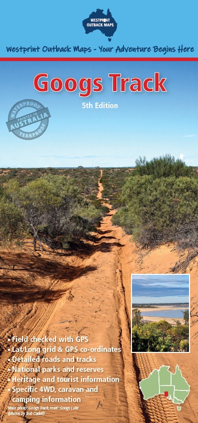

Description
This digital Westprint map covers the extent of Googs Track from Ceduna to Tarcoola and looping through to Kingoonya and Wirrulla. Googs Track is a 4WD track located in South Australia, running from Ceduna to the Tarcoola Road, with a distance of approximately 150km. It has been compared to a miniature cross between the Canning Stock Route and the Simpson Desert, with diverse landscapes including sand dunes, rocky outcrops, salt lakes, and mulga scrub. However, unlike those remote locations, Googs Track benefits from being close to a major town and is suitable for a two or three-day adventure.
This new 5th edition has been significantly updated and includes more information along the track and surrounding region to ensure a safe and enjoyable trip. It is now printed on a waterproof and tearproof strata for durability.
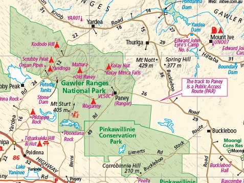
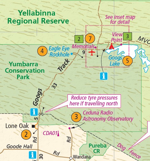
The track was named after John “Goog” Denton, who with his family owned the property Lone Oak. Goog believed that road access from Ceduna to the railway junction at Tarcoola would be of considerable value to the district and was so strong in his conviction that he set out to build the road himself. Others became influenced by his enthusiasm and offered support along the way, but Goog was the driving force and his family his main helpers.
Although Goog’s original vision was for a modern road, he may have been disappointed with the lack of support by the government. However, Goog would be delighted with the use his road now gets as an adventure trail. Camping is allowed along the track, with designated camping areas and basic facilities available at certain points. It is recommended to have a high-clearance 4WD vehicle, proper equipment, and to travel with others when attempting the track. However, the track is not recommended for novice 4WD drivers, and caution should always be exercised due to the remote location and potential hazards.
This digital version is available for OziExplorer in ozf4 format. Also available in PDF from Avenza Maps at https://www.avenza.com/avenza-maps/ and through the Avenza Maps App.


Reviews
There are no reviews yet.