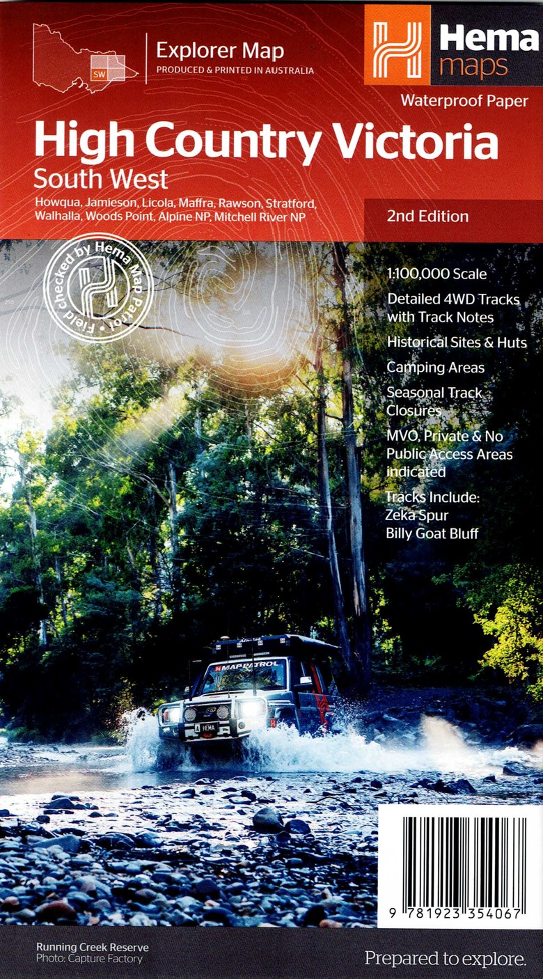
Description
The Victorian High Country – South Western Map delivers detailed topographic coverage of one of Australia’s most sought-after 4WD and touring regions. Known for rugged terrain, river valleys, and historical huts, this map provides all the essential detail needed for confident navigation. It’s an excellent tool for planning routes across both popular tracks and hidden gems.
Hema has included 4WD tracks with difficulty gradings, distances, and clear elevation shading, making it easier to choose routes that match your skill and vehicle capabilities. Camping areas, picnic spots, and points of interest are meticulously marked, helping travellers plan overnight stops and day adventures.
The map also highlights seasonal road closures, alpine access points, and important natural features such as state forests, rivers, and lookout points. This level of detail supports safe travel in the High Country’s dynamic weather and terrain conditions.
Perfect for 4WD enthusiasts, hikers, campers, and nature lovers, this map provides the reliable and accurate information that the Victorian High Country demands. It’s built for durability and crafted for explorers who want to truly immerse themselves in the region.
Key Features
Detailed 4WD tracks with notes
Historical sites & old townsites
Camping areas & huts
Road distances
Seasonal snowline and track closures
Accommodation
Tracks include; Zeka Spur, King Billy & Billy Goat Bluff
Latest bushfire affected areas.


Reviews
There are no reviews yet.