Select Page

Innamincka and Coongie Lakes

$14.95$28.95

  • 6th Edition
  • Scale 1:500,000
  • Field Checked with GPS
  • Detail roads and tracks
  • National Parks and Reserves
  • Specific 4WD, caravan and camping information
  • Cultural, historical and tourist information
  • Informative text about the region
SKU: W015A Category:

Description

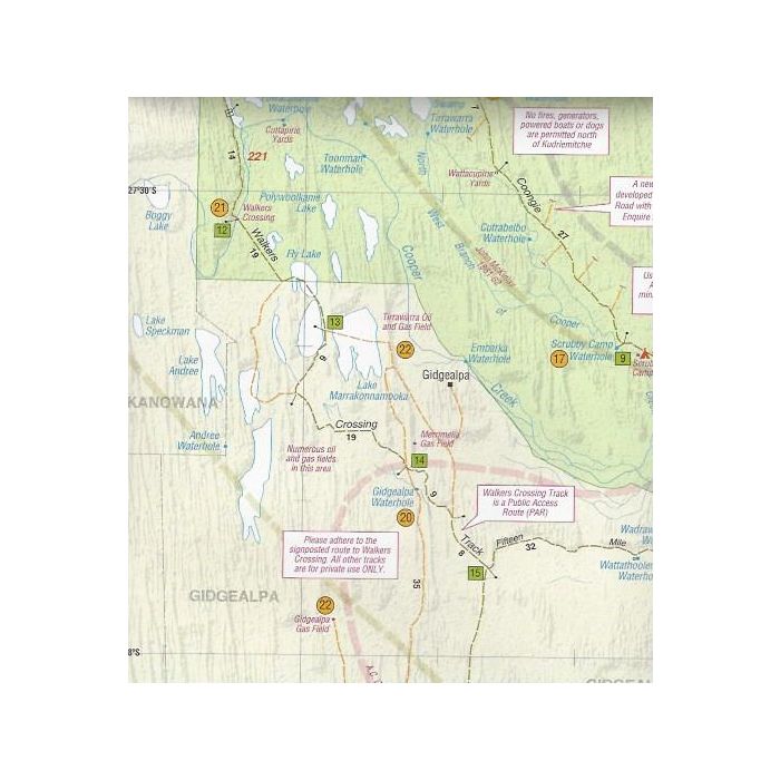
The Innamincka & Coongie Lakes area contains excellent camping and fishing locations along the lakes and waterholes of the Cooper Creek and is accessible only by 4WD. A permit is not required to travel to Innamincka via the Strzelecki Track, but a permit is required to travel from Innamincka to Coongie Lakes, shown on this map.
The required permit is the Desert Parks Pass, valid for one year covering all parks in the desert region. For travellers only requiring access to Coongie Lakes, a short stay pass is available from the Ranger based in Innamincka.
The map also features a good deal of information about Burke & Wills and their camp at the Dig Tree.

Additional information

Weight 0.126 kg
Format

Folded, Laminated

Notes

15th January 2024 – Please note closures within Innamincka Regional Reserve – 15 Mile Track is closed, along with Ski Beach Campground, Kings Marker, Wills Grave, Minkie Waterhole Campground.

National Parks and Wildlife Service South Australia | Office of the Executive Director Flinders and Outback

Reviews

There are no reviews yet.

Be the first to review “Innamincka and Coongie Lakes”

Your email address will not be published. Required fields are marked *