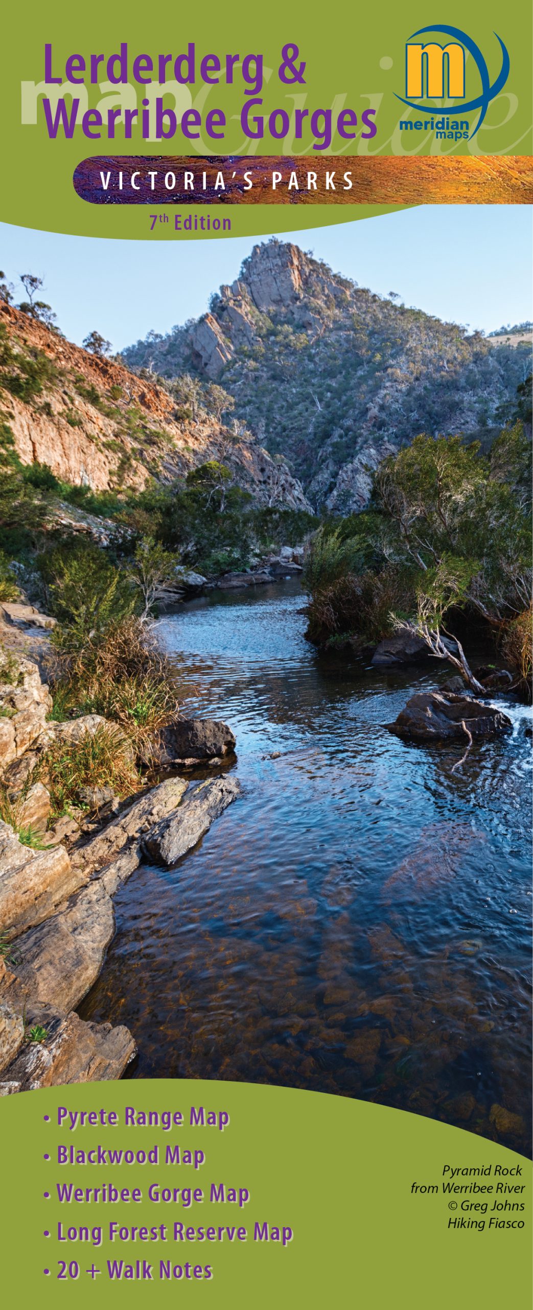


Description
Explore the New 7th Edition Maps of Lerderderg and Werribee Gorge State Parks.
Get ready for your next adventure with the latest 1:30,000 scale topographic map of Lerderderg State Park and the 1:20,000 map of Werribee Gorge State Park! There is also a 1:15,000 map of the Blackwood to O’Briens Crossing area and a 1:55,000 map of the stunning Pyrete Range. Plus, our new 1:40,000 map of Long Forest Reserve featuring six new walking trails!
What’s New?
This updated map offers 17 new and revised walking notes, along with fascinating information about the parks’ history, wildlife, and various activities. It also includes Emergency Marker Coordinates for both parks, making it a reliable companion for bushwalkers, day-trippers, and four-wheel drivers.
The Lerderderg River has carved a breathtaking gorge through this rugged park, conveniently located just an hour’s drive from Melbourne, Bacchus Marsh, and Ballarat. Enjoy a picnic at Shaws Lake or O’Briens Crossing, explore an old water race, hike part of the Great Dividing Trail, or take a leisurely stroll along the river from Mackenzies Flat Picnic Area.
Despite its proximity to the city, many areas of the park feel wonderfully remote. Don’t miss the stunning Lerderderg River Gorge, which runs from O’Briens Crossing in the north to Mackenzies Flat in the south—perfect for experienced hikers seeking dramatic views.
Bring the family for a barbecue by the river and then take a gentle stroll upstream to Grahams Dam. Set up camp at the Lerderderg Campground, a favorite spot nestled in beautiful woodlands.
Discover Werribee Gorge
Werribee Gorge State Park is a wild, rugged wonder shaped by 500 million years of geological history. Challenge yourself with various walking trails amid steep, river-washed gorges and rocky ridges, all offering spectacular views. For the adventurous, there are rock-climbing spots within the park. Self-sufficient visitors can picnic and explore this unique natural setting at their leisure.
Get ready to create unforgettable memories in these stunning parks!
Reviews
There are no reviews yet.