

Description
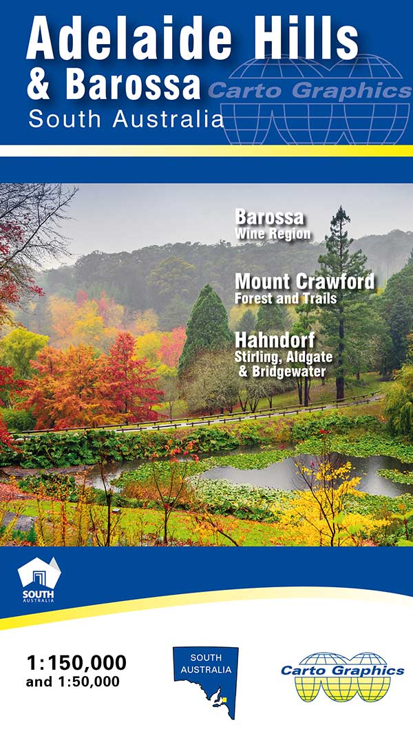
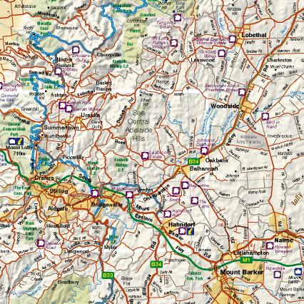
Adelaide Hills & Barossa Map. 1:150,000 scale covering Adelaide Hills region in South Australia from Strathalbyn to Kapunda, Adelaide to Murray Bridge. Detailed roads and road names, parks, cellar doors, hill shading and more. Clearly displays long distance trails, Heysen Trail, Mawson Trail, Kidman Trail, Lavender Federation Trail etc. Includes 1:50,000 inset blow-up map of the central area, Crafers to Hahndorf. Map reverse side has 1:75,000 scale Barossa Wine Region map and 1:50,000 scale topographic standard map for the popular Mount Crawford Forest and surrounds. Index for Towns and localities, parks and reserves, winery cellar doors.


Reviews
There are no reviews yet.