Description
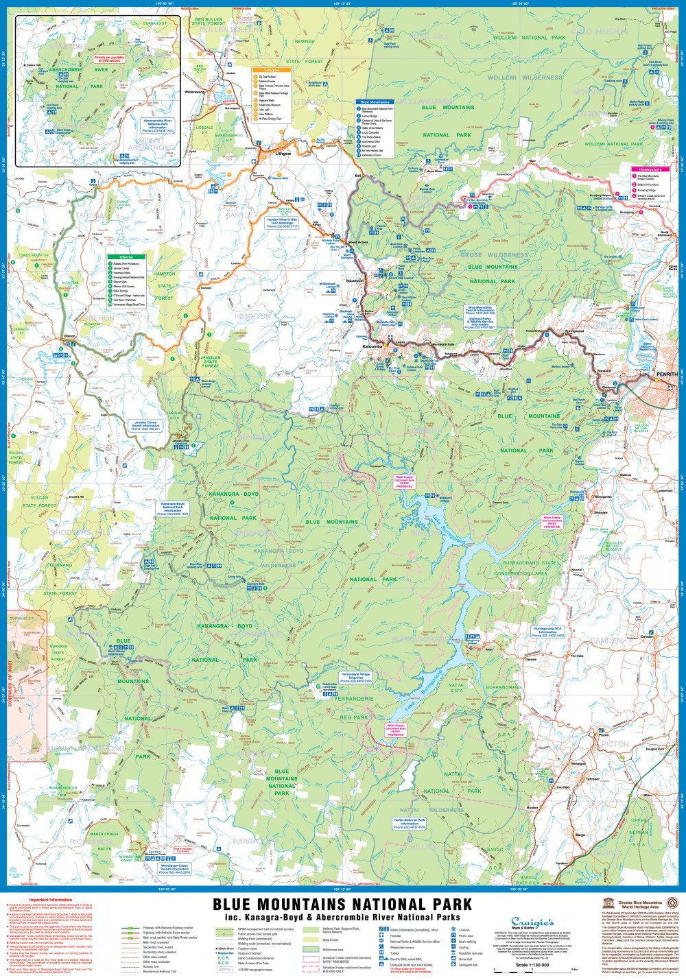
The Craigie’s Blue Mountains National Park Map at a Scale of 1:130,000 covers the Blue Mountains, Kanangra-Boyd and Abercrombie River National Parks extending from Lidsdale in the north to Wombeyan Caves and Bargo in the south.
This very detailed map includes road, highways, road shields, suburbs and towns. Wilderness, forest and water catchment boundaries are also marked along with a handy grid for the 1:25 000 NSW topographic map coverage.
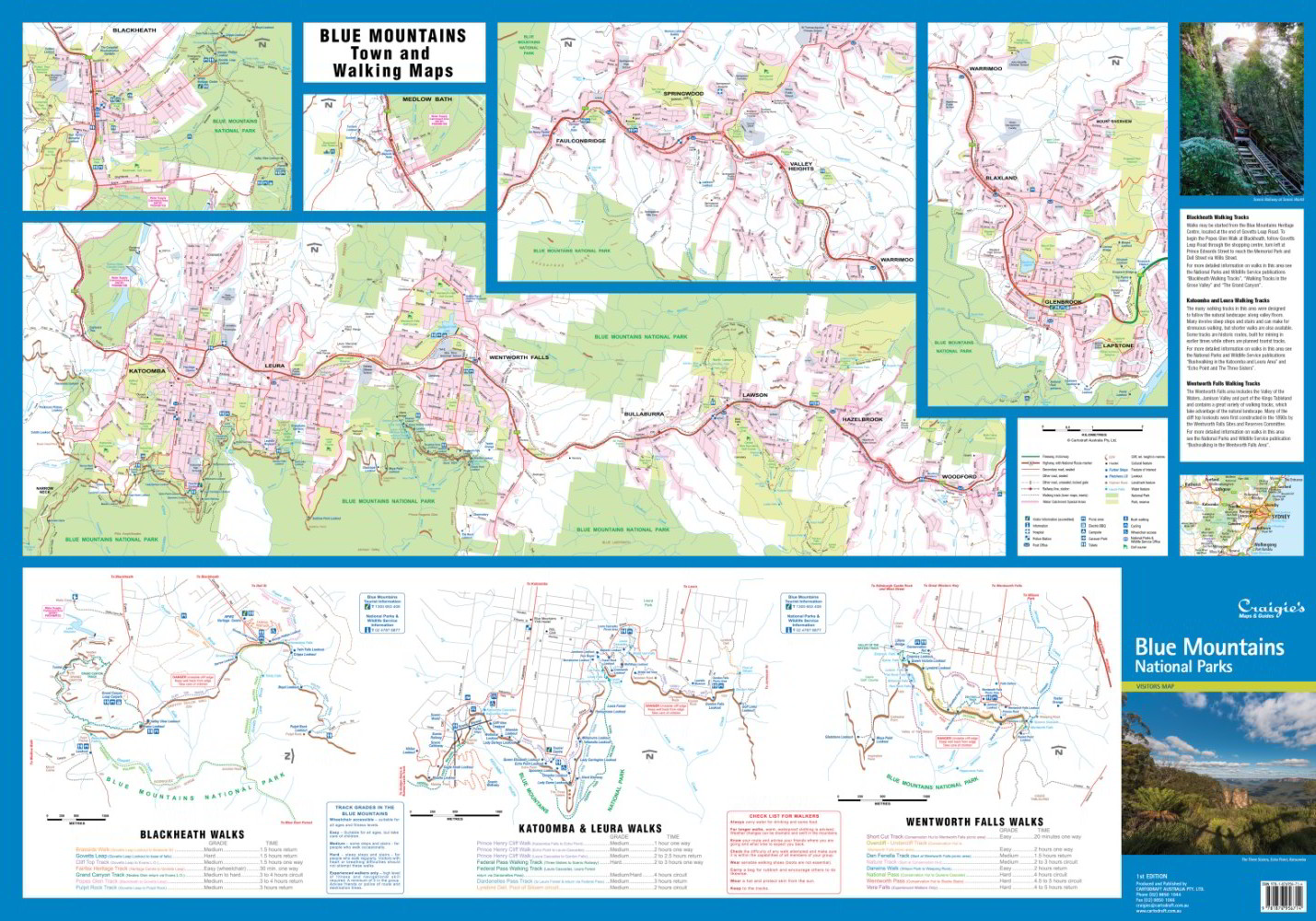
A very useful map as it allows visitors to plan their journeys, with many fire trails and walking routes noted. The reverse side features detailed town maps of Blue Mountains townships including Blackheath, Medlow Bath, Katoomba, Leura, Wentworth Falls, Bullaburra Hazelbrook, Woodford, Faulconbridge, Springwood, Valley Heights, Warrimoo, Blaxland, Glenbrook, Mount Riverview and Lapstone.
Also included are mud maps for Blackheath, Katoomba, Leura and Wentworth Falls walking tracks noting lookouts, walking times and track grades. Size (unfolded) 700 x 1000mm


Reviews
There are no reviews yet.