Description
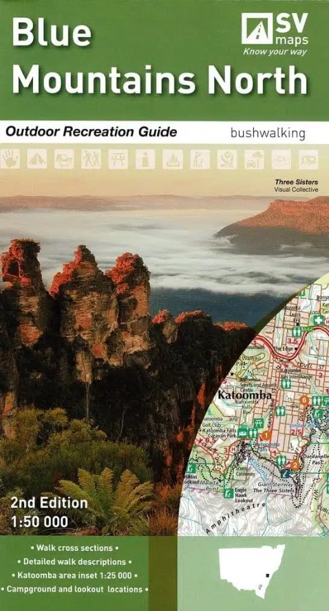
2nd edition of the Blue Mountains National Parks North Map at 1:50,000 published by Spatial Vision. Includes Yellomundee Regional Park LOCAL TOWNS including Mount Victoria, Blackheath, Medlow Bath, Katoomba, Leura, Wentworth Falls, Lawson, Springwood, Glenbrook.
Detailed walk descriptions including day walks such as the Grand Canyon and Prince Henry Cliff walk and overnight walks including Blue Gum Forest Circuit, Mount Victoria to Blue Gum Forest and Blackheath.
Information on other activities such as mountain biking, rock climbing, canyoning, canoeing and swimming.
Campground and Lookout locations and GPS references
1:25, 000 map inset of the Katoomba and Wentworth Falls area
Walk cross sections
Available as a Print on Demand map.


Reviews
There are no reviews yet.