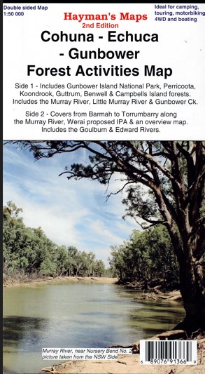
Description
Hayman’s Map including the Murray River Red Gum Forests, Perricoota, Koondrook, Campbell’s Island, Guttrum, Benwell & Werai State Forests.
The map is a large double sided map with photographs and notes. One side is a 1: 50 000 map covering the region bounded by Torrumbarry Weir in the south and Murrabit in the north. The Gunbower National Park and State Forest and Perricoota and Koondrook forests are covered in detail. Also Murrabit, Cohuna, Leitchville, Gunbower, Mead
Side two contains several maps. The main map is a 1: 50 000 map covering from Barmah to Torrumbarry, there is a 1: 75 000 map of Werai State Forest to the NW of Deniliquin and an overview map (1: 350 000) showing how the maps link together and access routes to the areas. Suitable for camping, touring, 4wd, fishing, boating, walking tracks and much more including Moama, Lower Moira, Yambuna, Barmah Kanyapella Game Reserve, Barnes
The Cohuna-Echuca-Gunbower Forest Activities Map and the Barmah Shepparton-Deniliquin-Adventure Map when combined provide continuous coverage of the Murray River from Tocumwal in the south to Murrabit (near Barham) in the north.
Scale: 1:50 000 main map
Scale: 1:75 000 inset map
Updated: 2014
Double sided with overlapping panel
Suitable for use with GPS
Extensive 4wd tracks coverage
Walking tracks and campsites
Map Size: 100cm x 70cm approx
Colour with contours, photographs & notes Laminated version also available.

Reviews
There are no reviews yet.