Select Page

Corner Country – Featuring Sturt’s Steps Digital Map

$12.95

  • 1st Edition – 2024
  • Scale 1:900,000
  • Field Checked with GPS
  • Detail Roads and Tracks
  • National Parks and Reserves
  • Lat/Long Grid and GPS Co-ordinates
  • Specific 4WD, caravan and camping information
  • Cultural, historical and tourist information
  • Informative text about the region
  • Digital Version in OziExplorer and GeoTIFF formats
  • PDF Version available from Avenza Maps
SKU: W036 Category:

Description

Experience the dramatic scenery, fascinating history, and exhilarating drives amidst the tiny goldfield towns of Milparinka and Tibooburra. Milparinka stands as a testament to its heritage with carefully restored buildings forming an award-winning heritage precinct. Tibooburra, retains a rich Aboriginal presence showcased at the Land Council’s Keeping Place Museum of Aboriginal artefacts.
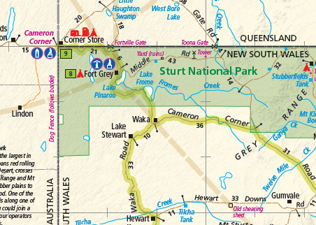
Sturt National Park, protecting an arid landscape, offers an unparalleled experience. Explore the red sand dunes of the Strzelecki Desert, the ancient mesas of the Grey Range, the ironstone Gibber Plains, and the world’s longest fence, the Dingo Fence.
Venture further to Mutawintji National Park, a protected expanse rich in indigenous heritage and natural wonders, offering an immersive experience in the Far West region of New South Wales.
This map is intended to aid in planning one of Australia’s remarkable outback adventures. The Corner Country offers an unforgettable experience, but its beauty should always be respected and appreciated.
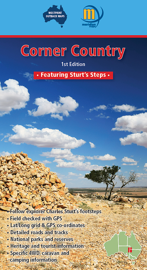
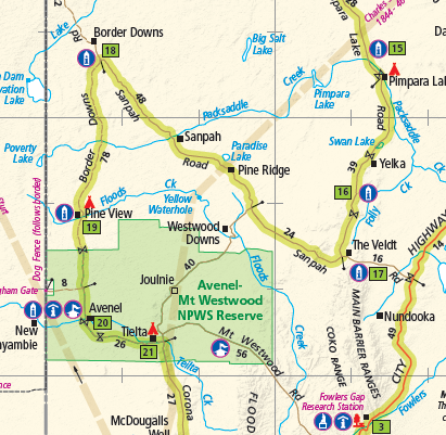
The Corner Country awaits your exploration, offering a journey through history, nature, and unparalleled beauty. Follow Sturt’s steps Touring Route which approximates the route taken by Captain Charles Sturt in 1845.
More information regarding the route is available at: https://visitcornercountry.com.au/about-sturts-steps/touring-route/
This digital version is available as OziExporer files and GeoTiff format. Please select the format of choice.

Additional information

Format

OziExplorer, GeoTIFF

Download Information

Instructions for downloading Ozf format maps

Please read these notes carefully before proceeding

Only buy these maps if you have OziExplorer software installed (or intend to install it) on your computer. A FREE Trial version of OziExplorer can be downloaded from: http://www.oziexplorer.com/

The maps are in OziExplorer (Ozf4) file format. Map image and calibration files are in a Zip folder and require Winzip or a similar program so they can be unpacked and made ready for use.

For each map you wish to purchase, click the “Add to Cart” link. If more than one map is required, continue shopping by adding further maps to the Cart.

Important

Once your order has been received, we will send a Hightail link by email to begin downloading the files.  Note: the download system works best for payment by credit card. (If you select payment by bank deposit, download will not begin until receipt of payment to our account has been confirmed. This may take at least 2 working days for your funds to appear in our bank account).

Please remember that these files are your personal use only.

Only maps suitable for use with OziExplorer navigation software are available for download from this site.

Reviews

There are no reviews yet.

Be the first to review “Corner Country – Featuring Sturt’s Steps Digital Map”

Your email address will not be published. Required fields are marked *