
Description
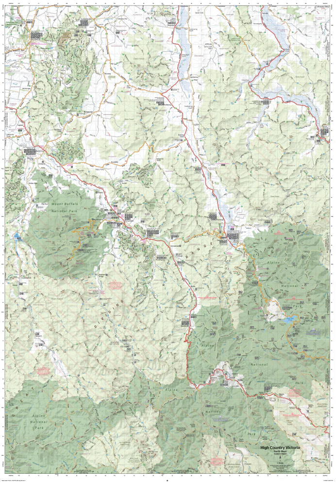
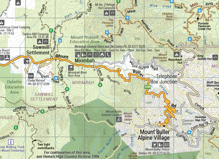
This map is part of Hema’s new Victorian High Country Map Series and covers the North-Western Alps Area. It overlooks Hotham, Wangaratta and surrounds including Bright, Bogong, Mount Buffalo, Dinner Plain and Falls Creek along with hundreds of 4WD tracks set among spectacular alpine scenery. Printed on durable waterproof paper, this map features Hema’s iconic mapping and extensive points of interest.
Featuring roads and 4WD tracks field-checked by the Hema Map Patrol for superior accuracy. It combines Hema’s entire database of roads and 4WD tracks with touring points of interest and topographic information. Also included are seasonal track closures, camping areas, old townsites, huts, accommodation and distances. It is a premier destination for four-wheel driving, hiking and outdoor recreation of all sorts.
Key Features
Detailed 4WD tracks with notes
Historical sites & old townsites
Camping areas & huts
Road distances
Seasonal snowline and track closures
Accommodation
Tracks include; Blue Rag Range Track & Craigs Hut
Latest bushfire affected areas.


Peter –
A big thank you to Meridian Maps! I’m based in QLD and attending a 4WD event next week in VIC High Country, and only thought about my lack of maps in the last couple of days. Thanks for the immediate response, and ensuring that I’ll have my hard copy maps delivered on site in VIC prior to me hitting the tracks. Your follow up service was great, well done to the team.