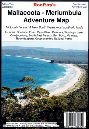
Description
Explore Australia’s Far South East Corner with the Rooftop Map of Mallacoota to Merimbula.
Includes: Bombala, Eden, Merimbula, Cann River, Wolumla, Wyndham, Wonboyn Lake, Ben Boyd National Park, Croajingolong National Park, South-East Forests National Park, Mount Imlay, Coopracambra National Park, Alfred National Park, Tamboon Inlet, Wingan Inlet, Mallacoota Inlet, Gabo Island etc.
Information includes walking tracks, vehicle tracks, roads, estuaries, watercourses, places of interest, navigation markers, boat ramps, jetties etc.
Insets of Gabo Island and Mallacoota Inlet.
Printed on waterproof paper.


Reviews
There are no reviews yet.