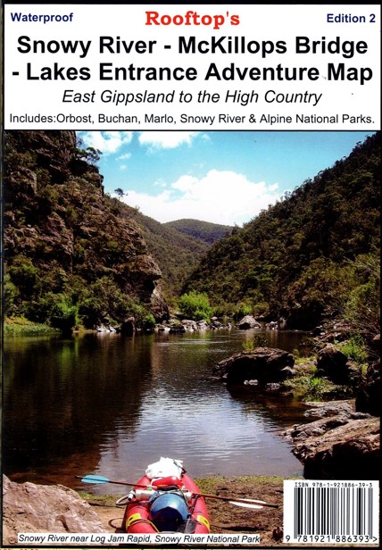
Description
2nd Edition of Rooftops’s Snowy River – McKillops Bridge – Lakes Entrance Adventure Map. Map coverage includes Johnsonville, Swan Reach, Lakes Entrance, Lake Tyers, Nowa Nowa, Ewings Marsh, Orbost, Buchan, Bruthen, Numerella, Corringle Beach, Marlo, Ensay, Deddick Trail, and parts of the Snowy River National Park, Alpine National Park and Great Alpine Road.
All parks, reserves and state forests are shown and all roads and tracks within the map area have been plotted using GPS mapping technology. The Snowy River from McKillops Bridge and Buchan has also been mapped with detailed plots showing camp sites and about 95 different rapids. rapids have been graded according to difficulty.
Scale is 1:100,000 and is printer on waterproof paper.
The reverse of the map has a 1:50,000 scale enlargement titled ‘Snowy River – Buchan Forest Activities Map’ with contours.


Reviews
There are no reviews yet.