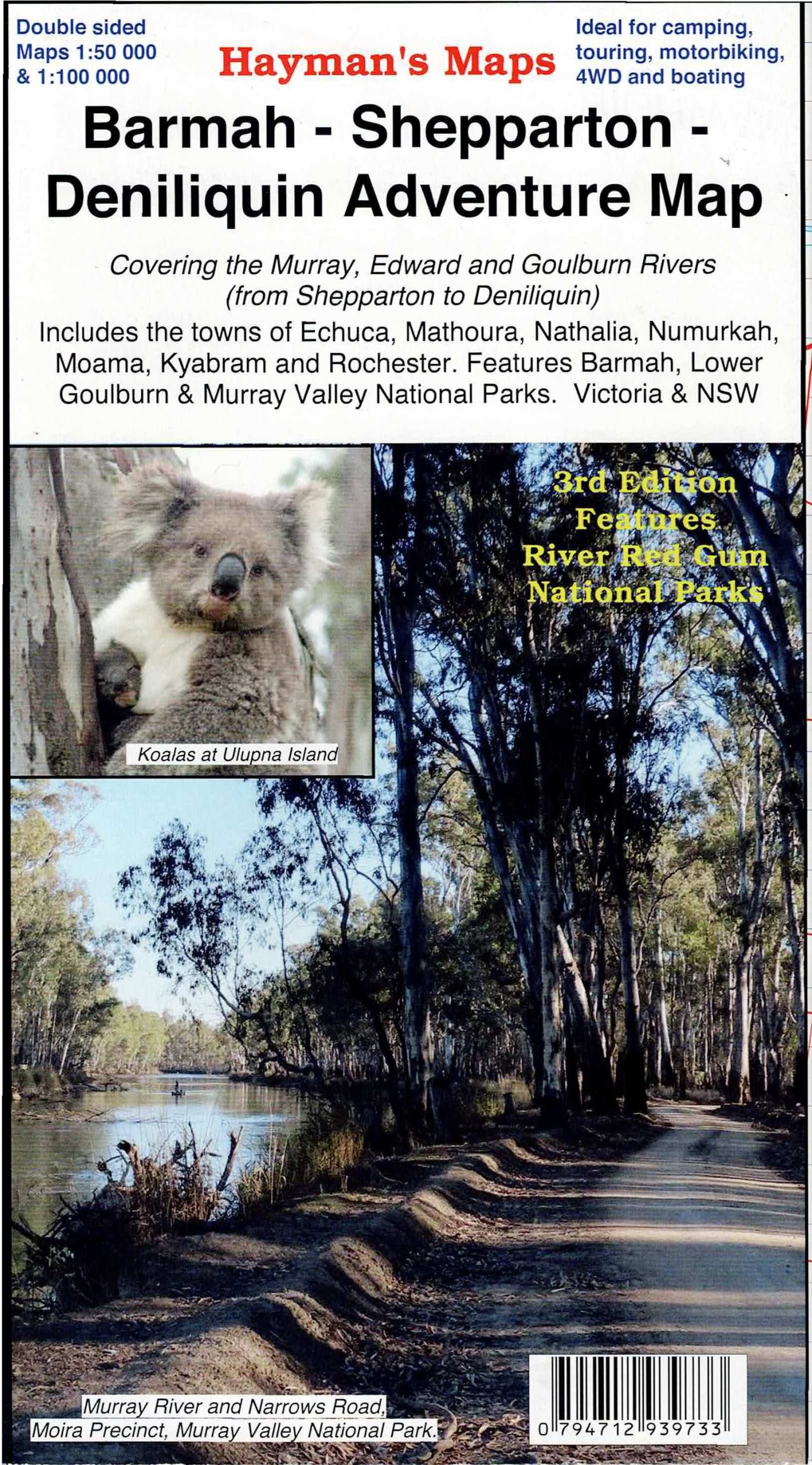
Description
Hayman’s Map covering parts of the Murray River, Edwards River and Goulburn River
This map extends from Shepparton in the South to Deniliquin in the north and from Tocumwal in the east to Murrabit (past Barham) in the west. The map is filled with tourist information including points of interest, national park information, picnic and camping sites, walking tracks and accommodation. This 3rd edition shows highlights the Barmah National Park and Murray Valley National and Regional Parks. The various precincts within the Murray Valley National Park are also shown including; Gulpa Island, Millewa and Moira Precincts. The map is a large double sided map with photographs and notes.
Side 1 is a 100 000 map covering the region bounded by Shepparton, Rochester, Echuca, Deniliquin, Strathmerton. Mathoura, Moama, Nathalia, Numurkah, Bearii, Barmah and Barmah National Park, Waaia, Wunghnu, Katunga, Tongala, Kyabram, Girgarre, Mooroopna, Wyuna, Undera, Merrigum,
Side 2 is a 50 000 map covering in greater detail Barmah National Park, Millewa, Moira, Gulpa Island, Ulupna Island and Tocumwal forests, Mathoura, Barmah, Picola Point Moira Lake, Murray Valley National Park, The Gulf Camping and Picnic Areas and the Murray River. Ideal for camping, touring, 4wd, motorbiking, horse riding, fishing, boating, cultural sites and much more.
Scale: 1:50 000
Updated: 2021
Double sided with overlapping panel
Suitable for use with GPS
Extensive 4wd coverage
Walking tracks and campsites
Map Size: 100cm x 70cm
Colour with contours, photographs & notes
ISBN 794712939733

Reviews
There are no reviews yet.