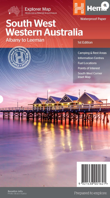

Description
Embark on an unparalleled journey through the breathtaking landscapes of South West Western Australia with our meticulously crafted map, designed to be your trusted companion in exploration. This first edition of the Hema Maps South West Western Australia Map is a testament to our commitment to providing detailed, accurate, and user-friendly cartographic solutions for adventurers and explorers.
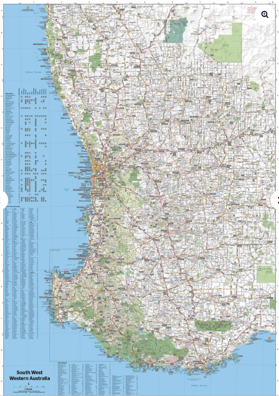
On the main side is a comprehensive map of South West Western Australia (at 1:700,000 scale) stretching from Albany in the South, Margeret River, Busselton, Bunbury in the South West up through Perth and stretching as North as Leeman. On the reverse side is a detailed map of the South West Corner (at a 1: 200,000 scale) including the Wellington National Park, Leeuwin-Naturaliste National Park and D’Entrecastreaux National Park.
The southwestern portion of Western Australia has a spectacular coastline, great surfing beaches, flowing rivers, tall forests, wineries, farms, quaint towns, bustling cities and numerous other attractions. While forest communities remain quiet, the coastal area from Bunbury to Margaret River and Augusta bursts at the seams on long weekends.
The Southern Forests feature many opportunities for memorable encounters of the tree kind, and the region also has a stunning coastline. Almost the entire coast is within national parks and there are many great opportunities for four-wheel driving. To get a real taste for the vast wilderness protected by D’Entrecasteaux National Park, your best bet is by 4WD. Lake Jasper via Black Point is one of the favourite 4WD routes in the South West. The Great Southern area stretches from Denmark across to Albany and up to Mt Barker, taking in the Porongurup and Stirling ranges. Between Denmark and Albany is West Cape Howe National Park which offers to challenge 4WD tracks, fantastic camping at Shelley Beach, remnant karri forest and Western Australia’s most southerly point at Torbay Head.
Blessed with milder summer temperatures than Perth, the South West corner is popular in spring for the wildflowers. The winter months are often wet and windy, especially along the southern coast. Visitors should also be aware that total fire bans apply in many areas throughout the summer months.
Key Features
Camping and rest areas
Information Centres
Fuel Locations
Points of Interest
South West Corner inset map


Reviews
There are no reviews yet.