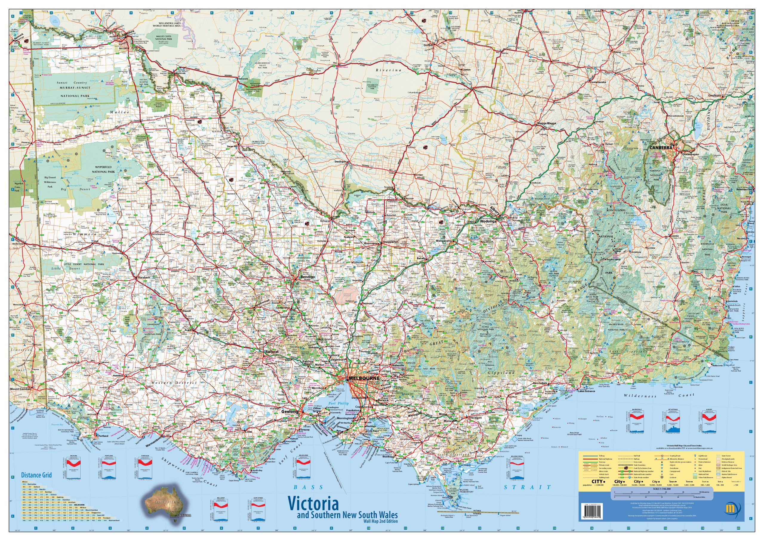
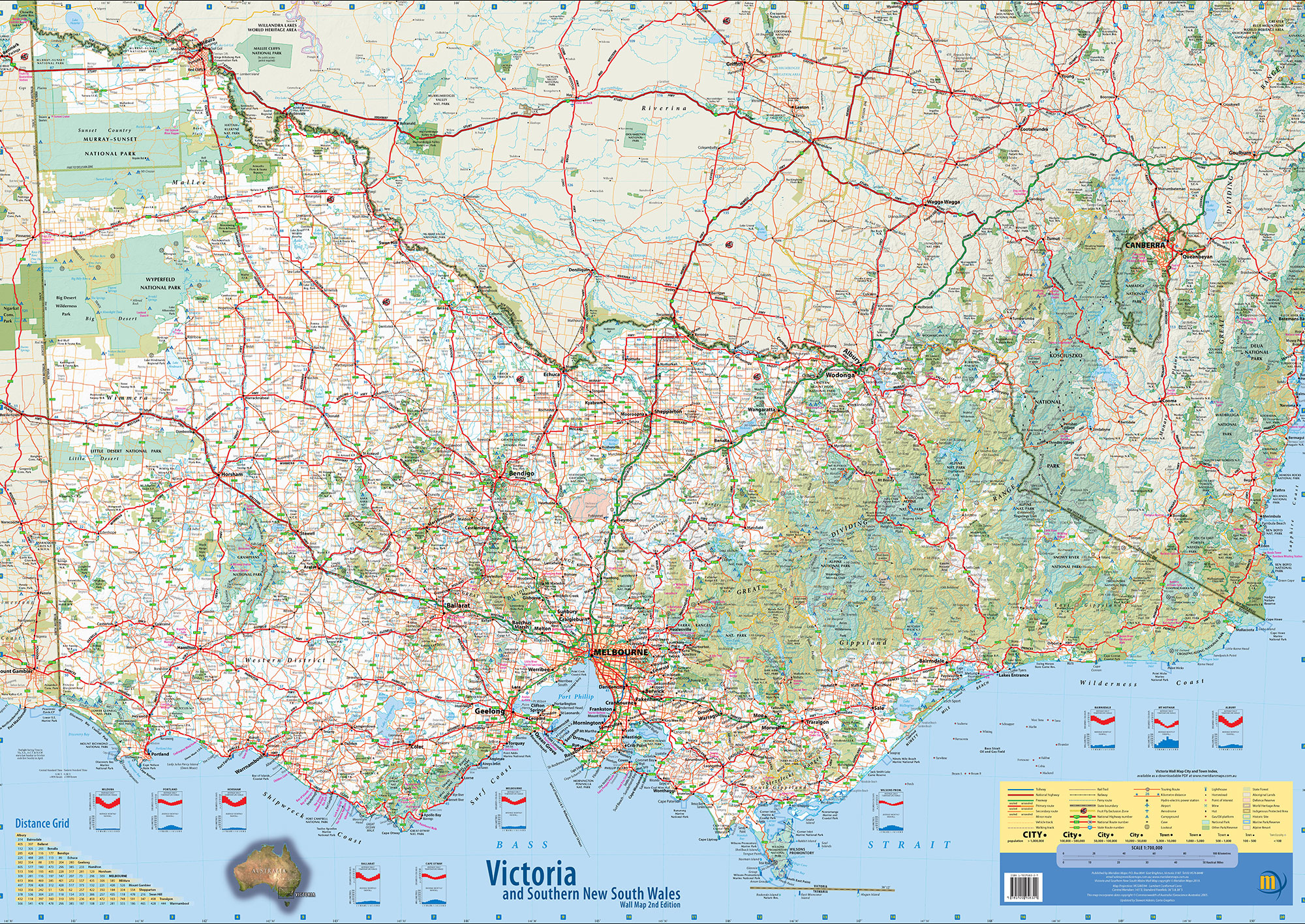
Description
This 1:700,000 scale detailed wall map of Victoria and south-east New South Wales highlights top tourist attractions, national parks, state forests, campgrounds, and key points of interest. Designed for clarity and ease of use, it’s the perfect reference tool for business, travel planning, or educational purposes. The map also includes a distance chart and climate data for added convenience. The laminated version offers added functionality and durability—it can be used with whiteboard markers or map dots to highlight specific locations without leaving permanent marks. The protective lamination also guards against wear, tear, and stains, making it a long-lasting addition to any wall.

harrie –
love this map, high up on my home wall and is used a lot for weekend trips. everyone that walks in the house has a look at it. would love the same style for NSW as well.