
Description
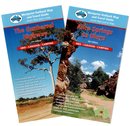
This Map pack covers the Great Central Road from Laverton (WA) through to Yulara and Alice Springs (NT). The maps included are The Gunbarrel Highway and Alice Springs to Uluru. It is a mostly unsealed Australian outback highway that runs 1,126km. It passes through a number of small communities on the way. It forms part of the Outback Way which goes all the way to Winton, Queensland. Though still recommended only for four-wheel drive vehicles, the road is now graded to a standard suitable for two wheel drive vehicles and caravans. It is on the most direct route from Perth to Uluru / Ayers Rock, with many thousands of vehicles travelling the route annually.
These maps have been field checked with GPS and contains Lat/Long grid & GPS co-ordinates, detailed roads and tracks, National parks and reserves, heritage and tourist information and specific 4WD, caravan and camping information.
All Westprint maps contain notes on history, explorers, points of interest, surrounding flora and fauna and contain various photos of landmarks. The maps are very clear to read and have road distances, rest areas, caravan parks and fuel outlets noted. Westprint map are more than just a map. Explore the Great Central Road with the Map Pack and learn about the region at the same time.

Reviews
There are no reviews yet.