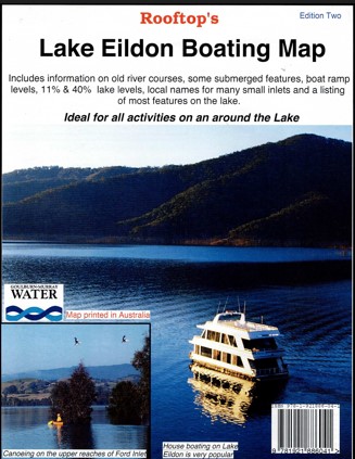
Description
Explore Lake Eildon with this 1:70,000 boating Map from Rooftop Maps.
This a special map focusing on all the relics, ruins and sites submerged when the lake is full and appearing only as the water level recedes.
There is a detailed table of GPS co-ordinates pin-pointing something like 140 sites of interest.
Coverage includes the whole of Lake Eildon, Lake Eildon National Park, plus lakeside towns and villages. Boat ramps and service barges are shown with the full percentage required to be accessible by boats. The old river courses have also been plotted. The reverse of the map has a map of the pondage and Eildon township plus lots of statistics on the lake.
Facility symbols include Camping Areas, Caravan Parks, Toilets, Bush Huts, Picnic Areas, Fuel Barges, Boat Ramps, Helipads, Water Points and more.
The map also includes, roads; vehicle, buoy identification, motorcycle and walking tracks; distances from dam wall, and GPS co-ordinates.
Laminated version also available.
Reviews
There are no reviews yet.