Description
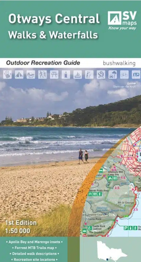
Otways Central: Walks & Waterfalls Map – by Spatial Vision
Discover the heart of the Otways with this detailed Walks & Waterfalls Map from Spatial Vision. Covering key locations including Deans Marsh, Barongarook, Barwon Downs, Lorne, Forrest, Lake Elizabeth, Wye River, Kennett River, Skenes Creek, Apollo Bay, and Marengo, it’s an essential guide to the region.
Designed for outdoor adventure, the map is ideal for bushwalking, mountain biking, trail bike riding, car touring, four-wheel driving, and water sports.
This updated map of the central Otways Range features comprehensive topographic detail to help you explore the area’s diverse landscapes and recreational highlights. It includes a wide selection of walking tracks—both short and long—along with detailed notes for each.
Inset maps of Forrest, Apollo Bay, and Marengo provide a closer look at local walking routes and recreational features. The Forrest inset also showcases the extensive network of mountain bike trails in the area.
On the reverse, you’ll find informative content on the region’s history, major attractions, native flora and fauna, and GPS references for key recreational sites.

Reviews
There are no reviews yet.