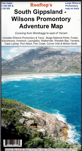
Description
Explore the South Gippsland and Wilsons Promontory with this Rooftop Map.
Map coverage includes Wilsons Promontory & Tarra – Bulga National Parks, Foster, Korumburra, Inverloch, Leongatha, Walkerville, Waratah Bay, Yanakie, Cape Liptrap, Port Albert, Fish Creek, Corner Inlet, Mirboo North, Yarram, Woodside and Wonthaggi. Scale is 1:100,000.
The reverse of the map has a 1:50,000 scale enlargement titled ‘Wilsons Promontory Forest Activities Map’ with contours.
All parks, reserves and state forests are shown and all roads and tracks within the map area have been plotted using GPS mapping technology. All walking tracks in Wilsons Promontory National Park have been recently field checked with detailed plots showing camp sites, navigational notes and important features.
Laminated version also available.

Robbie –
This is a very helpful map if you’re planning activities at the Prom. As usual Rooftop’s maps are annotated with useful tidbits which help you work out where to go, how difficult the terrain “really” is, and what the more appealing landmarks and views are. Recommended!