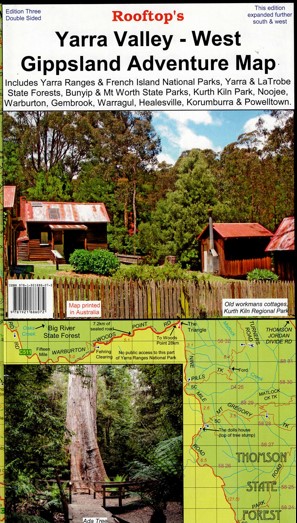
Description
Explore the Yarra Valley and West Gippsland with this 1:100,000 scale map. Coverage is from Marysville, Narbethong and Cumberland Junction in the north to Mount Worth, Pakenham and Trafalgar in the south. It includes Yarra Ranges National Park, Bunyip State Park, Yarra State Forest, Gembrook, Kurth Kiln, Noojee, Neerim South, Warragul, Powelltown and Mount Worth State Park.
The reverse of the map has a 1:50,000 scale enlargement titled ‘ Gembrook – Noojee Forest Activities Map’ with contours. Starlings Gap, Ada Tree, Neerim, Labertouche Cave, Jindivick, Spion Kopje, Vesper, Big Pats Creek, Britania Creek
All parks, reserves and state forests are shown and all roads and tracks have been plotted using GPS mapping technology.
Laminated version also available.


Reviews
There are no reviews yet.